A land-ice simulation code
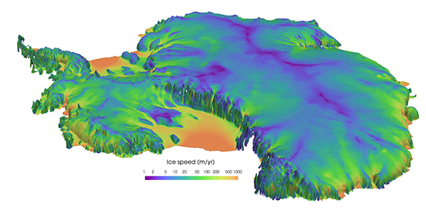
An Albany/FELIX simulation of Antarctica shows surface velocities draped over a surface topography computed on a variable resolution mesh.
As part of the five-year multi-institution DOE/SciDAC [Scientific Discovery Through Advanced Computing] project PISCEES, Sandia has developed a land-ice simulation code that has been integrated into DOE’s Accelerated Climate Model for Energy earth system model for use in climate projections. The Albany/FELIX code enables the calculation of initial conditions for land-ice simulations, critical for stable and accurate dynamic simulations of ice sheet evolution and the quantification of uncertainties in 21st century sea level rise. With NASA, the team has successfully validated simulations in comparison to actual Greenland ice sheet measurements. (8900,1400)
NCRT leverages a rigorous methodology that originated with the Lab’s mission to ensure a safe and reliable nuclear stockpile.
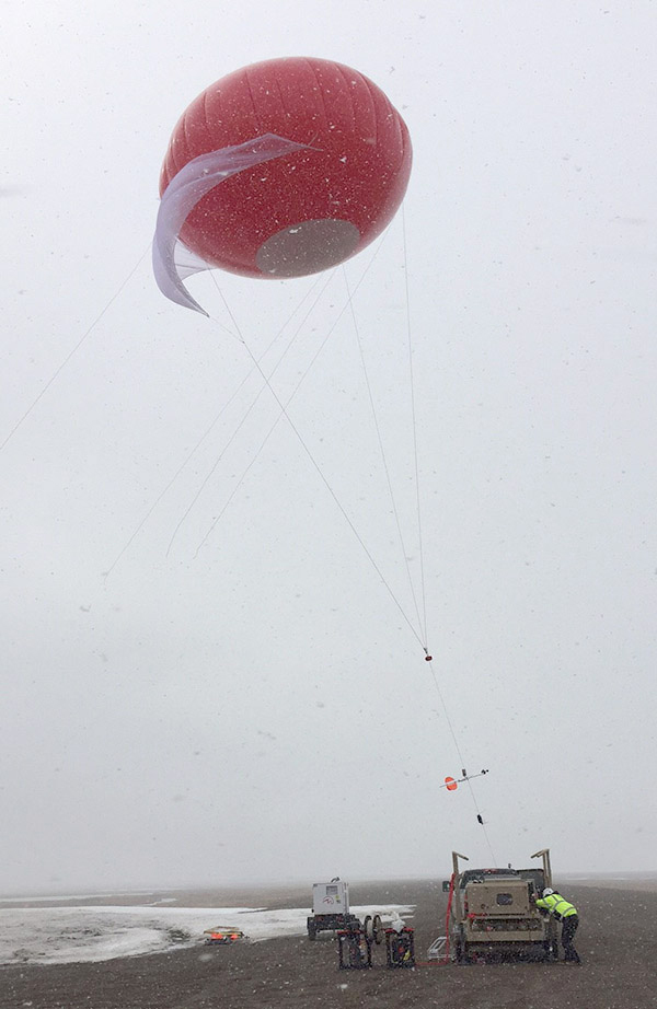
In 2016, Sandia researchers flew tethered balloons at DOE research facilities on the north coast of Alaska within Arctic clouds for 65 hours to more than 3,500 feet above the surface. Atmospheric measurements were collected as part of the Inaugural Campaigns for Atmospheric Radiation Monitoring Research using Unmanned Systems (ICARUS). A distributed temperature-sensing system and super-cooled liquid water sondes were operated for the first time in the Arctic during these balloon flights. Concurrent measurements from an unmanned aerial vehicle represent another first in the Arctic. (6900, 4100)