It’s a local twist to a nationwide problem: potential unexploded ordnance (UXO) at old bombing ranges.
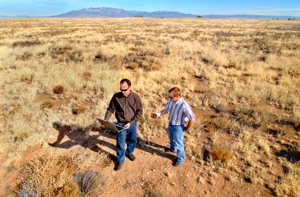
Several intact 250-pound bombs were recently discovered during a construction project at the old Kirtland bombing range near Double Eagle Airport on Albuquerque’s West Mesa. Since then the bombs have been safely removed from the area.
A complete site survey was conducted after excavation of a new sewer line turned up the 250-pound bombs. Expansion of the Eclipse Aviation facility near Double Eagle Airport has also necessitated adding water and power lines. The survey of the Kirtland site, one of the national Wide Area Assessment (WAA) sites, was initiated and funded by DoD’s Strategic Environmental Research and Development Program (SERDP) and the Environmental Security Technology Certification Program (ESTCP).
However, the main result of the survey by this team showed no evidence of any target areas south of the runways.
“This southern portion of the site completely encompasses the area in which Eclipse Aviation is expanding, so good news for them,” says Sean McKenna (6313), project team leader. “We did identify several other potential target areas north of the airport; some of these turned out to be geological noise such as magnetic rocks. About three of them turned out to be legitimate potential ordnance target areas.”
Site characterization
Sandia, along with members from Pacific Northwest National Laboratory (PNNL), used lidar (light detection and ranging) imagery to remotely characterize the Kirtland site. The imagery revealed several features indicative of UXO targets. The lidar provided a high-resolution topographic map of the area and focused on old targets such as concentric circles, a ship outline, and other areas of interest, Sean says.
The entire site was characterized using two complementary geophysical techniques: magnetometers and electromagnetic induction. The techniques were run simultaneously on a specially designed trailer pulled by a dune buggy. This technique, done by Geo-Centers (now SAIC), is known as Vehicular Simultaneous Electromagnetic Induction and Magnetometer System or (VSEMS). In addition, a helicopter-mounted magnetometer was used to survey the entire site, including some areas south of the Double Eagle runways that were not surveyed with the VSEMS.
“These geophysical tools don’t have the discrimination power to identify UXO versus scrap metal, but they do a good job of identifying locations with relatively larger concentrations of metal in the ground,” says Sean. “Typically, these areas are the target locations we’re interested in.”
Project conception
Research on the development of the project techniques was funded by SERDP beginning in 2000. Work funded by SERDP focuses on basic research. The ESTCP subsequently funds initial field application and verification of technologies developed under SERDP funding.
Sandia received ESTCP funds for initial “field” testing that involved application of algorithms to simulated sites; no field sites had been adequately characterized and excavated to a point where they could be used for validation. Characterization of the simulated sites was successful.
ESTCP recently organized a set of wide-area technology assessments and demonstrations. These wide-area studies involved testing and evaluating a number of UXO technologies at a given field site. The field sites for the wide-area assessment have been chosen based on visibility and urgency of the need to remediate the land. Urgency is generally driven by someone else wanting to use the land.
Sandia has been involved with various WAA research sites including the Pueblo site in southeast Colorado; Toussaint River, an underwater site in Lake Erie off the north shore of Ohio; the Victorville site in southern California; and the Camp Beale site north of Sacramento.
“The reason for the different sites across the country is to test the different technologies on various topography, soils, site areas, expected number of target areas, and anomaly densities,” says Sean.
Overall, as much as 20 million acres of land in the US — that’s about half the size of Maine —could possibly contain UXO. The unexploded ordnance is left over from wars as well as from decades of live-fire training and practice in the US. “UXO presents a discrete and acute health hazard, but not the same as the land-mine problem,” says Barry Roberts (6313), a member of the team. The Kirtland site was used for training during and after WWII.
In addition, data collected from known historic target sites at Laguna and Isleta pueblos have been used for development of various research techniques. The data sets, funded by SERDP, were mainly collected to test the helicopter-mounted magnetometer being built by Oak Ridge National Laboratory. “We also used the data for the statistical algorithm development work, but did not complete any reports regarding the two sites,” Sean says.
Work in progress
Currently the team is writing up final reports for the Pueblo, Victorville, and Kirtland sites. The Sandia team has completed work on the conceptual model for Camp Beale and worked with the Corps of Engineers and PNNL to come up with a transect design for that site. The ground magnetometer surveys will begin there this month.
This year, ESTCP has funded Sandia and PNNL to develop a training course for state and federal regulators and contractors involved with site characterization and cleanup using these methods. The first course will be offered in August.