Remote sensing can be used to address many national security concerns, but until now it could take a team years to explore existing technology, develop reference designs and study how to best address the challenge.
Valhalla, a Python-based performance modeling framework developed at Sandia, uses HPC to run thousands of mission simulations to produce a preliminary design for a satellite or space system in just weeks.
Increasingly, a constellation of small satellites working as a system instead of one large satellite is being considered for remote sensing missions. Valhalla designs a satellite and then populates multiple copies into a constellation and simulates the system executing the specified mission. Valhalla can also model how groups of non-identical satellites with different features work together to execute a given mission.
Designing a space system with Valhalla is similar to customizing a new car online. A user visits Sandia’s internal Valhalla website and selects the features and parts needed to execute the mission. The first step is to provide Valhalla with mission requirements that can be parsed into quantitative goals, including:
Determining the level of fidelity and detail needed by specifying if the satellite system will need to detect, identify, categorize or associate objects or events.
Selecting the class of object or event to search for, including vehicles, explosions, aircraft, boats, space debris and other satellites.
Selecting the frequency of data collection — how often the system should revisit the target objects or events.
Selecting the target’s motion model — will the system need to observe the trajectory of trucks traveling from one location to another, or will it need to observe a city, region, or neighborhood of interest or monitor objects or events across the globe?
Specifying any constraints — for example, the system may need to be compatible with a specific external network.
Selecting a mission operation center to feed the images and data captured by the satellite.
With the mission requirements clearly defined, the next step is to select parts such as on-board computers, radios, batteries, reaction wheels, sensors, propulsion tanks and thrusters and GPS receivers from a component catalog with about 2,500 parts to choose from.
Valhalla takes all the selected parts and creates a baseline satellite design by using encoded interface control documents, engineering-best practices and rules-based logic. It sizes the payload, structure, solar arrays and batteries and optimizes the mass of the satellite and its compatibility with various launch vehicles.
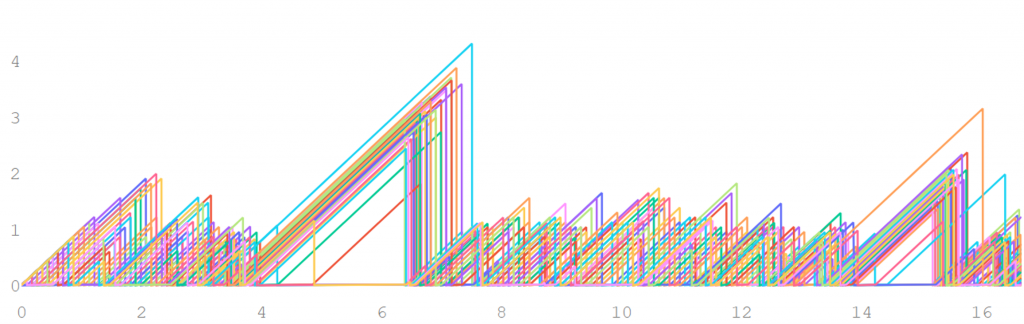
Valhalla then populates the baseline design into a constellation and simulates the space system executing the specified mission by running a day-in-the-life power model simulation. The simulation compares the mission performance metrics against space systems goals and repeats that process thousands of times using a Monte Carlo algorithm.
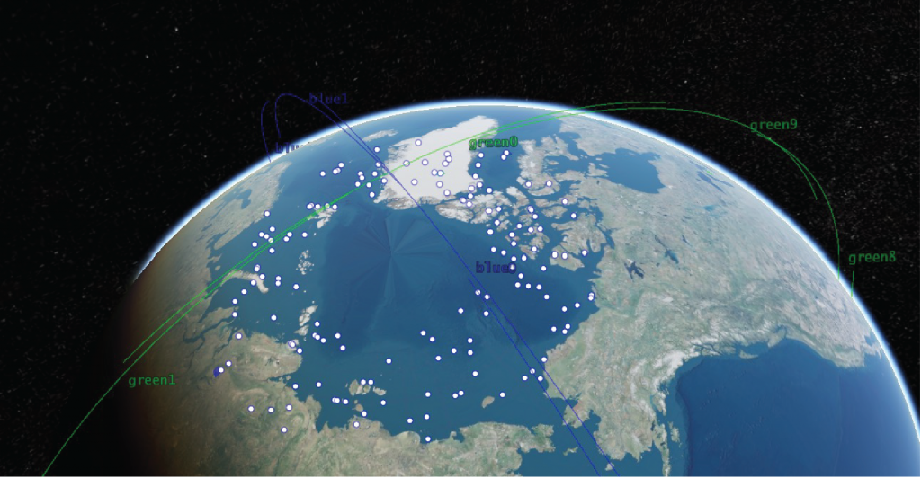
Valhalla also models the space system’s orbital dynamics and the gravity harmonics of the earth, moon and sun to simulate the space environment each satellite will experience over the course of the day.
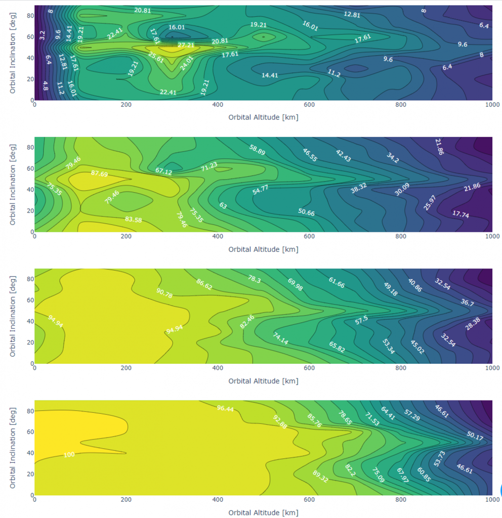
There are thousands of variables and relationships to consider when designing a space system for a specific national security mission. Valhalla visualizes the relationship between variables so the user can see how the overall space system is affected when parameters that are relevant to each other change. For example, the desired altitude of the spacecraft will affect the size of the telescope needed and vice versa. As the altitude of the satellite increases, the telescope also needs to become more powerful, but the system will need fewer satellites to provide enough sensing coverage to execute its mission.
A critical component of this process is autonomous operations. Typically, satellite systems require a team of operators to build a task list for the constellation. Valhalla uses a novel set of autonomy algorithms to simulate data fusion, sensor-target optimization and signature collection performance. To run faster than real-time, which is required to run these simulations thousands of times, the satellites need to be able to task themselves within the simulation. Valhalla does this through the Shortstack code base developed at Sandia to optimize sensor placement. Shortstack is an optimization routine that produces sensor target pairing to maximize information gain.
Tracktable, a code base developed at Sandia, is another routine integrated into Valhalla. It takes billions of data points in historical data and uses neural networks to fit hypothesized target trajectories based on data collected by satellites in the simulation.
Valhalla includes a cost analysis tool, developed by the Aerospace Corporation, that estimates the program cost of a satellite system based on the selected components, orbits and sub-system mass ratios.
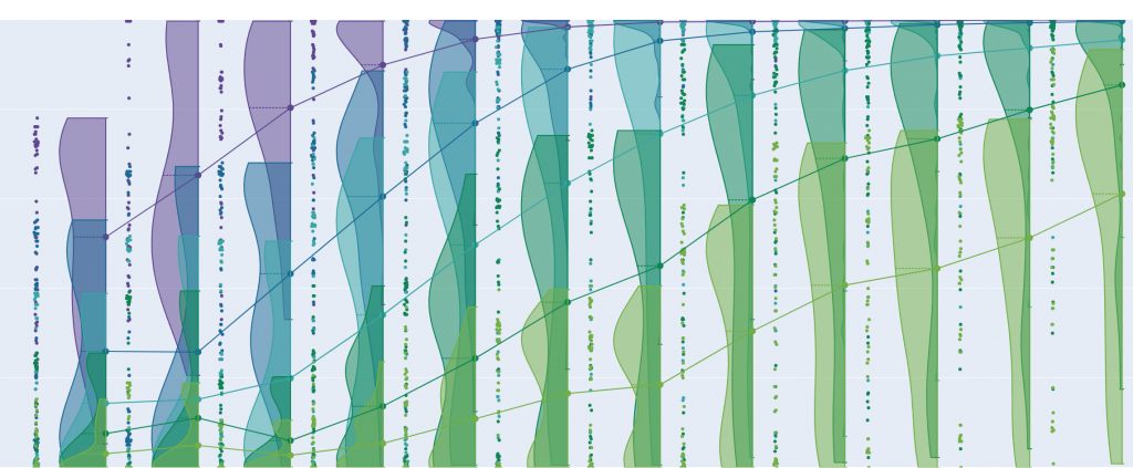
The simulation data is post-processed in a GPU cluster. The GPU takes all the data from the simulation and combs through it to correlate performance metrics across variable sets to produce an N-dimensional hypersurface that provides the user with hundreds of plots, including a 3D visualization of the constellation executing its mission, revisit and collection statistics, launch vehicle compatibility and simulated satellite telemetry feeds.
All the data is presented in a visual, digestible format that allows users to see why certain simulation runs produce better performance metrics than others. The user then selects the solution that best fits the mission based on the data and plots provided. Valhalla gives the user the information they need to rapidly understand the national security challenge in a mission context and design a space system that meets the unique mission requirements. This enables teams to focus on delivering national security solutions in months rather than years.
Valhalla has been used to:
- Explore space systems for enhanced arctic security.
- Study the effects of neuromorphic computing on space system design.
- Simulate tracking and monitoring the rescue of refugee vessels in the Mediterranean.
- Explore satellite fault tolerance and identification of single-point and dual-point failure paths.
- Analyze satellite rendezvous and proximity operations.
- Perform satellite threat resilience analysis.
- Study novel intra-satellite communication networks.
A future goal of Valhalla is to use cost as a performance metric and build a mapping of satellite requirements to program cost, allowing national security programs to identify the cost-critical features of a specific mission or to see how to improve performance while maintaining the cost profile constraints from customers.