MODES & FREQUENCY BANDS OF OPERATION
Multi-mode and tailored systems to meet mission objectives
Sandia’s world-class Synthetic Aperture Radar (SAR) systems offer an expansive set of radar modes ready to be packaged and utilized on both manned and unmanned platforms. Sandia’s radar systems are custom designed and developed with the right frequencies, modes, and methods for meeting the customer’s specific mission needs.
FEATURED RADAR MODES
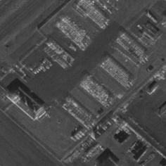
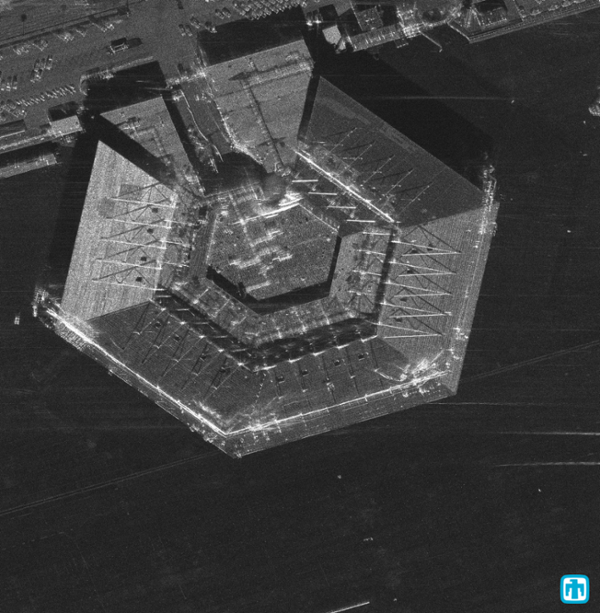
Synthetic Aperture Radar (SAR)
Spotlight
This mode increases resolution significantly by steering the radar beam toward the target for a longer time, providing a longer exposure through the synthetic aperture. Spotlight Synthetic Aperture Rader (SAR) mode of operation is usually at the expense of spatial coverage, but in conjunction with other modes, Sandia is able to use spotlight SAR on missions to track movement and changes in environment.
SpotDwell
SpotDwell is the point-and-shoot mode of the Sandia radars. The radar operator need only specify the coordinates of the Scene Reference Point (SRP) and the radar does the rest. The coordinates of the SRP can even be specified by clicking on the map within the operator interface. In this mode, the radar will form images of the SRP until imaging geometry limits are exceeded.
Circle
While it is called the “circle” mode, to the radar the circle consists of a series of straight-line segments that form a polygon. Only one image or patch is formed for each side of the polygon and the aperture is always centered on the respective side.
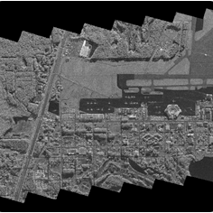
Stripmap
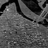
The conventional Synthetic Aperture Radar (SAR) strip-mapping mode assumes a fixed pointing direction of the radar antenna broadside to the platform track. A stripmap is an image typically formed parallel to the aircraft ground track that can be as long as the user desires. Stripmap azimuthal resolution is limited by the azimuth beamwidth of the antenna, which is a function of its size and other operating properties. Stripmap range resolution continues to be limited by the bandwidth of the transmitted signal.
Sandia was the first to develop a system that produced real-time stripmap imagery at both 1-foot resolution (1991) and 6-inch resolution (2005) from airborne platforms.
Arbitrary Stripmap
Similar to stripmap, this imagery is produced along a line that is oriented in an arbitrary direction relative to the aircraft flight path.
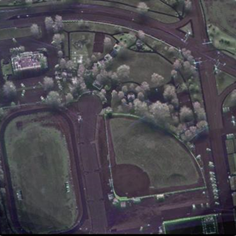
VideoSAR & VideoCCD
Sandia has developed highly advanced “VideoSAR” algorithms (holding a number of patents for both VideoSAR and Velocity Sandia develops highly advanced “VideoSAR” algorithms (holding several patents for both VideoSAR and Velocity Independent Continuous Tracking Radar (VICTR) modes) which enable revolutionary Intelligence, Surveillance, and Reconnaissance (ISR) in a radar sensor. VideoSAR offers continuous collection and processing of phase history data, allowing observation of slow-moving targets day or night and during inclement weather or atmospheric conditions. Time between images is user-selectable and independent of aperture length. Sandia developed VideoCCD as a by-product of VideoSAR which allows continuous real-time change detection observation between successive passes. VideoCCD not only enables the analyst with real-time change information but also displays a history of change in the scene.
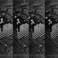
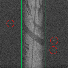
Coherent Change Detection (CCD)
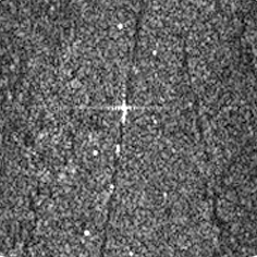
This is a highly sensitive technique that identifies subtle differences that occur in a ground scene between two Synthetic Aperture Radar (SAR) passes. To detect whether a change occurred, two images are taken of the same scene, but at different times. These images are then geometrically registered so that the pixels align in each image. After the images are registered, they are cross-correlated. Where a change has not occurred between the imaging passes, correlation remains high. If a change has occurred correlation will be low.
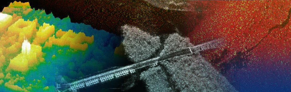
Interferometric Synthetic Aperture Radar (IFSAR)
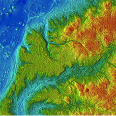
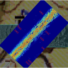
Interferometric Synthetic Aperture Radar (IFSAR) utilizes two or more Synthetic Aperture Radar (SAR) images collected from slightly different grazing angles to yield a topographic map of the scene. The SAR images are coherently compared or “interfered” to determine the phase differences between image pixels, creating an interferogram. This product allows target scene topographic height information to be calculated. Sandia fields both two-pass and single-pass, multi-phase center antenna, real-time Interferometric Synthetic Aperture Radar (IFSAR) systems.
Polarimetry
Polarimetry is a technique in which the radar is designed to illuminate a scene with a known polarized electromagnetic field, and likewise detects and quantifies the polarization of the backscattered responses. Use of the measured polarization scattering matrix data for a targeted scene has demonstrated to be a significant aid in detecting and discriminating various target types and features.
Moving Target Indicator
Ground Moving Target Indicator (GMTI)
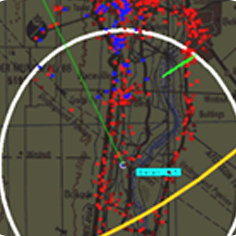
Moving objects in a radar’s field of view are detected by measuring their backscattered energy’s Doppler shift with respect to the stationary background clutter. This mode is used to track moving surface objects in an area of interest where situational awareness is required.
Endo-Clutter GMTI
A slow-moving target causes a small Doppler shift that might not be enough to place its energy outside of the clutter Doppler bandwidth. Detecting this target ‘inside’ the clutter requires suppressing the clutter echoes or finding a way to discriminate between stationary clutter and the moving object. This typically requires the addition of a second (or more) antenna phase center to allow additional interferometric (phase comparison) processing. This can be done with a second antenna, split aperture antenna, or monopulse antenna.
High Range Resolution (HRR)
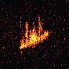
The typical Ground Moving Target Indicator (GMTI) mode is about simply detecting the moving target, and consequently, where range and Doppler resolutions are relatively coarse. A vehicle typically takes up a single pixel in a range-Doppler map. With High Range Resolution (HRR), a moving target takes up several pixels, yielding a Radar Cross Section (RCS) range-direction profile of the vehicle. This assists in target discrimination and classification.
Maritime / Maritime ISAR
Martime Search Mode
Maritime Search Mode is the classic scanning radar mode that relies on azimuth resolution from the real antenna beamwidth. It is sometimes called Real-beam Search Mode. A Real-beam Search Mode for ships at sea must deal with the unique clutter characteristics of ocean waves.
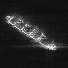
Maritime Inverse Synthetic Aperture Radar (Maritime ISAR)
Typical Synthetic Aperture Radar (SAR) presumes a moving radar with known motion, and a stationary target scene. If the target object to be imaged is moving, then the processing of an image is called Inverse Synthetic Aperture Radar (ISAR). Early turntable data collection devices were called ISAR ranges. More recently, imaging moving objects such as ships and land vehicles with unknown motion is also referred to as ISAR image processing.
Vibrometry
Vibrometry is the detection and measurement of vibrating objects in a Synthetic Aperture Radar (SAR) image. Vibration characteristics can offer equipment feature clues. A periodic vibration generates sidelobes in the SAR Doppler-frequency response, which can be used to detect and analyze vibrations from a target of interest.
Stereo Processing
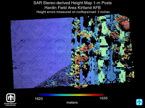
Two Synthetic Aperture Radar (SAR) images formed from suitably different data collection geometries can be compared such that feature displacements from one image to another can be analyzed to calculate height or topographic information. Stereo Processing is a natural technique for generating high-quality topographic maps.