Two Sandians brave subzero temperatures, frozen tundra to deliver vehicle to research site
Sandia’s arctic and atmospheric research is vital to understanding the effects of climate change in the Arctic and around the world. Every year, scientists battle the Alaskan wilderness to collect critical data, but none of their cutting-edge research would be possible without dedicated operations and logistics staff who ensure Arctic facilities, supplies and vehicles are safe and ready to use.
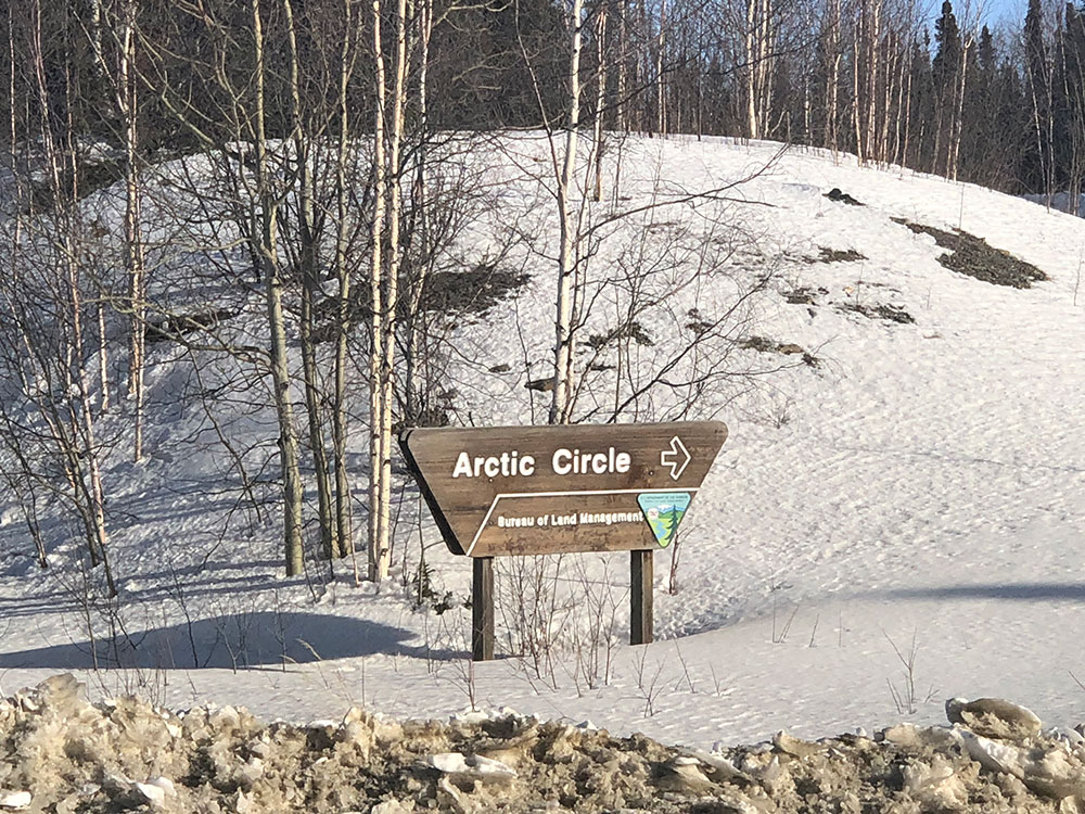
Sandia engineer Fred Helsel and technologist Valerie Sparks recently went above and beyond their usual duties to deliver a new General Services Administration vehicle to the DOE’s Atmospheric Radiation Measurement user facility in Utqiaġvik, Alaska, formerly Barrow. Fred, North Slope of Alaska operations manager for the Sandia-operated observatory, and Valerie, who has supported logistics for Sandia’s Alaskan facilities for over a decade, spent four days in April braving miles of frozen tundra and avalanche-ridden passes to personally deliver a new Ford Expedition that will serve as crucial transportation for Sandia staff and their arctic and climate change research.
“Earlier in the year we started having trouble with our current GSA vehicle in Barrow [Utqiaġvik], and we found out the Ice Road was open. So, Fred and I were going up there anyway and we just decided, we should do this road trip. It was a win-win: We get the vehicle to Barrow [Utqiaġvik] quickly, and we get a once-in-a-lifetime experience on the Ice Road,” Valerie said.
Packed to the gills on the Ice Road
The first day of the trip was the easy leg, stretching from Anchorage six and a half hours north to Fairbanks. Here, Fred and Valerie collected supplies required for their long voyage across the frozen tundra just days away.
“We were packed to the gills,” Valerie said. “We had to carry 35 gallons of extra fuel, two spare tires, three days’ worth of extra food and water, extra arctic clothing and we even set up a rack on the back of the vehicle to carry what we couldn’t fit inside.”
On April 4, Valerie and Fred ventured 497 miles farther north from Fairbanks to Deadhorse on the Dalton Highway, better known as the Ice Road. This gravel highway is considered one of the most isolated in the world.
“When they said, ‘Ice Road,’ I was expecting a road of pure ice, but it’s really more of a snow trail. It goes across rivers and lakes that are frozen, and that’s why you have to do it before it all melts,” Fred said.
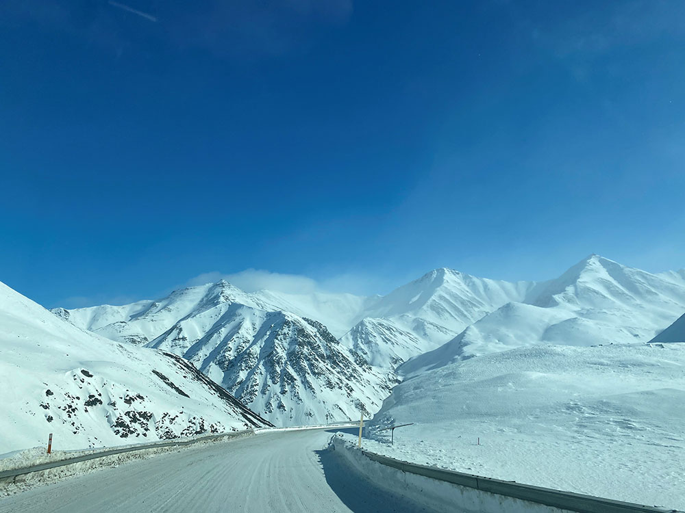
The drive lasted 10 1/2 hours and took them through Atigun Pass, where the Dalton Highway crosses the Continental Divide at 4,739 feet. This portion of road is the highest pass in Alaska that is open year-round and was one of the more dangerous legs of the journey due to severe avalanche risk.
“On the Dalton Highway between Fairbanks and Deadhorse, it’s an uncomfortable feeling when you see signs that tell you not to stop on this road because of avalanches. There are markers on the road every 100 yards that are way up on poles, so if an avalanche sweeps through, you can see the marker above the snow and tell emergency crews where you were swept off the road,” Fred said.
Despite the possibility of life-threatening avalanches, Fred and Valerie did not overlook the opportunity to enjoy the natural beauty.
“It was beautiful. It’s also pretty cool because you can see the lines down the side of the mountain where the avalanche snow falls down. We saw lots of wildlife in this pass too — musk ox, moose, wolf, wolverine and caribou,” Valerie said.
Orientation and preparing for the open tundra
After braving Atigun Pass and the Ice Road, Valerie and Fred spent a day in Deadhorse prepping for the final stretch of the journey to Utqiaġvik. To preserve and protect the frozen tundra, travelers must adhere to strict environmental protocols, including attending an orientation hosted by Arctic Slope Regional Corp., the local guide company that ensures safe and ecologically conscious travel from Deadhorse to the surrounding villages.
“The guides were amazing. They respect nature. Most of them have done this on the tundra on snow machines or four-wheelers their whole life. It’s just their life. However, we brought our own satellite phone, just in case,” Fred said jokingly.
The orientation provided Fred and Valerie an opportunity to reflect on their upcoming journey across the tundra on the Community Winter Access Trail and served as a final checkpoint to ensure they had all the required supplies to make the dangerous drive. The purpose of the trail is to give locals and others an alternate option to transport goods and vehicles, rather than be solely dependent on extremely costly air freight or barge services.
‘Caravan to Barrow is a go’
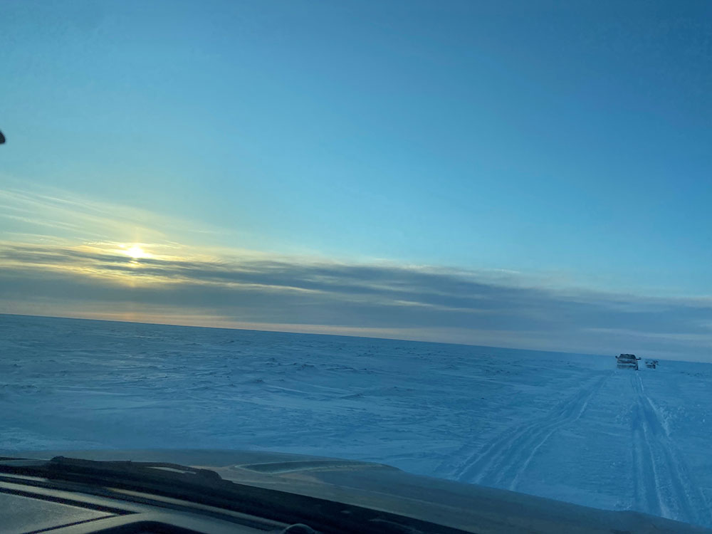
The morning of April 6, Fred and Valerie woke up to subzero temperatures and a 243-mile stretch of tundra to traverse before reaching their destination.
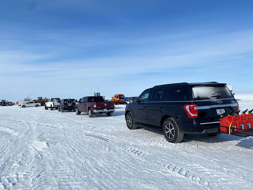
“It was only 243 miles, but it took us about 13 1/2 hours because there are a lot of stops. You have to go through security checkpoints and gates along the way, and the whole time you’re being escorted,” Valerie said.
The escorts provided walkie-talkies that allowed them to stay in constant contact with Fred and Valerie. Because the stretch of road from Deadhorse to Utqiaġvik is only open part of the year, in the spring before the rivers and lakes melt, the escorted convoys serve as an opportunity for locals to pick up critical supplies, including new cars.
“When we were leaving Deadhorse, the guides came on the radio and they said, ‘Caravan to Barrow is a go.’ That was cool. That stuck out in my mind as an aha moment of the trip. We were really going to do this drive,” Valerie said.
The caravan pressed on over the frozen tundra, stopping only once to fuel in a wind chill of negative 22 degrees Fahrenheit. Travelers are required to remove all waste they produce during the trip, and they are barred from venturing off the road onto the untouched tundra to ensure a minimal ecological footprint.
“The tundra is like a giant sponge. If it’s not frozen and you step on it, your foot will sink into the top layer. So, it’s best to travel when the tundra is frozen to avoid negatively impacting the environment. That’s why you have to stay on the road with the escorts, because you can’t tell where the road ends or what’s on the side of the road under the snow,” Fred said.
After driving 25 mph all day, through potholes and uneven terrain, Fred and Valerie safely delivered the Ford Expedition to Utqiaġvik, Alaska, the evening of April 6. They completed the 1,088-mile journey in just four days, avoiding exorbitant vehicle barge shipping costs and ensuring the Sandia staff had a safe, working GSA vehicle for daily transport to and from the Atmospheric Radiation Measurement user facility.
The cost of climate change
Fred and Valerie’s trip provided a prime opportunity to see Alaska’s inland beauty, enormous rivers and mountain passes, but it also provided time for reflection on how much the terrain has changed since they both began working in Alaska.
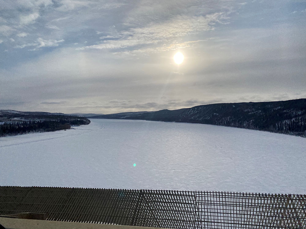
“I’ve been working up there so long that I’ve seen a lot,” Valerie said. “The main road to town runs along the ocean. You used to be able to see the waves from the road, but now the road has a berm next to it to protect the road from being washed out by the ocean. Eventually, better means of mitigation will be required to protect Utqiaġvik from coastal erosion.”
Fred has also witnessed the severe and often disheartening effects of climate change in the Arctic.
“With the time I have spent in the Arctic, the three most noticeable changes I have experienced are coastal erosion from the Chukchi and Beaufort Seas, the region’s permafrost layer changing and longer periods of warmer temperatures during the summer,” Fred said.
In addition to monitoring these changing conditions, Sandia scientists develop and improve regional Arctic and Earth system models to help decision-makers anticipate further environmental changes and risks facing these isolated communities.
Road tripping, again?
“I would like to do the Dalton Highway again, but not the (Community Winter Access Trail). It’s too stressful. The vehicle hits bumps and holes and wants to steer itself — you really have to focus the whole time. It’s not a soft ride. It’s more of a 13-hour bumping, slamming ride. It was loud and nerve-racking. It was rough,” Fred said.
Valerie, on the other hand, is open to departing on the whole adventure again.
“It was an interesting drive, and I want to do it again someday,” she said. “That’s one of the reasons I’m still here in this group, because it’s just a once-in-a-lifetime experience — full of amazing things I’ve never experienced before.”